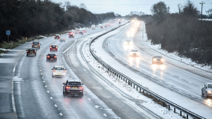
Snowfall in south-east England has triggered a series of pile ups and travel disruption on the roads as forecasters expect “one of the coldest weeks of this winter so far”.
Snow, sleet and ice warnings kicked in on Monday for large parts of the country as police urged motorists to drive carefully and allow extra time for journeys after “heavy snowfall” on a stretch of the M20 caught out early morning commuters and caused collisions involving several vehicles.
Kent Police tweeted images of the smashes, including one of an overturned vehicle, warning drivers: “Be aware. Extra time. Allow space watch for changing road conditions. If you get stuck stay with your car leave engine running. If you are able, Low gear low revs keep moving.”
Tweeting footage of officers driving through the snow, the force added: “It’s now full on Millennium Falcon at light speed weather now over a lot of our network. So watch your speed and sudden road changes. Watch out for static vehicles and drive safely #goinglightspeed #snowontheroad #drivewithcare.£”
Kent Fire and Rescue added: “WARNING – Please take care on #Kent’s roads this morning, there’s risk of ice and we’re expecting #snow too – up to 3cm – enough to make journeys a little more tricky. Please drive to the conditions, keeping speeds down and lights on #drivetoarrive.”
The Met Office has warned the mercury could plummet as low as -7C in some parts of the UK this week, while the bulk of the population can expect to shiver through sub-zero temperatures.
About 1cm to 3cm of snow could accumulate inland, mainly over hills above 100 metres, with up to 5cm predicted above 200 metres.
:: UK weather: The latest Sky News forecast
The first of a series of yellow weather warnings for ice and snow is in place for southeast England, London, and east England until 10am on Monday.
The second is an ice warning affecting the East Midlands, east and northeast England and Yorkshire and Humber, also until 10am today.
A third snow and ice warning affecting Scotland, Wales, West Midlands and Yorkshire and Humber begins at 8pm on Monday and continues until 3pm on Tuesday.
Experts say ice is expected to develop across western Scotland and Northern Ireland during this period.
A fourth yellow warning comes into play from 5am on Tuesday until 9am on Wednesday affecting the Highlands, Northern Ireland, southwest Scotland, Lothian and Borders, Strathclyde, Wales and southwest England.
The cold snap is expected to grip Britain until at least next weekend, with the chance that milder weather may not arrive until the middle of the following week.
Met Office forecaster Craig Snell said it would probably be “one of our coldest weeks of this winter so far”.
He added: “It’s going to be a very cold spell across the UK and our message is to allow some extra time for your journeys.
“Untreated surfaces will be prone to some ice and there could be some disruption to travel.”


